Google Maps Distance Matrix Service is a versatile tool that provides accurate travel distance and time estimates between destinations. Businesses and developers can leverage this service for a wide range of applications, from logistics and transportation management to location-based services and more.
Understanding Google Maps Distance Matrix Service
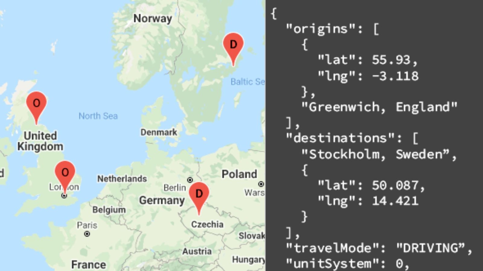
The Maps Distance Matrix Service from Google Maps API calculates travel distance and journey duration based on different modes of transportation, including driving, walking, and cycling. It offers valuable insights into route optimization and travel planning.
Optimizing Delivery Routes
Logistics and Delivery Services
Logistics companies use the Distance Matrix Service to optimize delivery routes, minimizing travel time and fuel costs. By calculating the most efficient routes based on current traffic conditions, businesses can improve operational efficiency and customer satisfaction.
Real-Time Traffic Analysis
Traffic Management
Integrate real-time traffic data from the Distance Matrix Service to analyze traffic patterns and congestion levels. This information helps city planners and transportation authorities make informed decisions about road infrastructure and traffic management strategies.
Location-Based Services
Geolocation Applications
Developers of geolocation applications utilize the Distance Matrix Service to provide users with accurate travel estimates between points of interest. This enhances user experience by offering reliable information for trip planning and navigation.
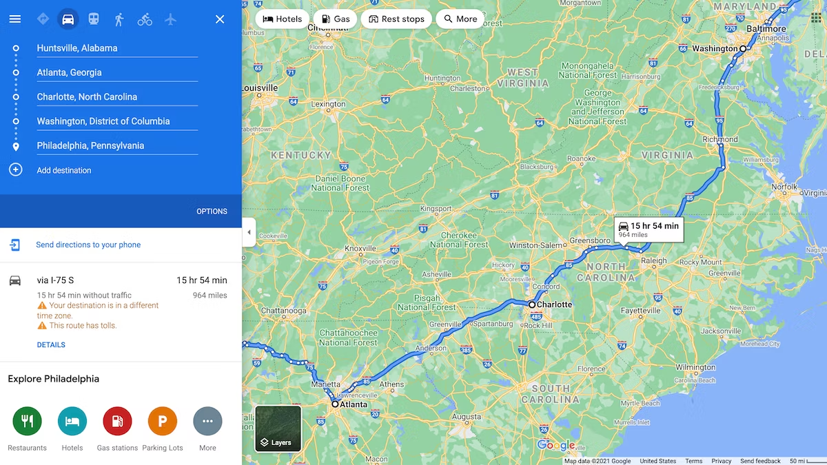
Multi-Stop Route Planning
Travel Planning Tools
Travel agencies and online booking platforms use the Distance Matrix Service to plan multi-stop itineraries efficiently. By calculating distances and travel times between multiple destinations, these tools facilitate seamless travel arrangements for users.
Fleet Management Solutions
Vehicle Tracking Systems
Fleet management systems integrate the Distance Matrix Service to track vehicle locations and monitor routes in real time. This improves fleet efficiency, ensures timely deliveries, and enhances overall fleet management capabilities.
Local Business Integration
Location-Based Marketing
Local businesses leverage the Distance Matrix Service to implement location-based marketing strategies. By understanding travel distances from potential customers, businesses can tailor marketing campaigns and promotions effectively.
Cycling and Walking Routes
Urban Planning
City planners use the Distance Matrix Service to develop cycling and walking routes that promote sustainable transportation options. By analyzing distances and travel times, cities can encourage active lifestyles and reduce carbon emissions.
Integration with Other APIs
Seamless Integration
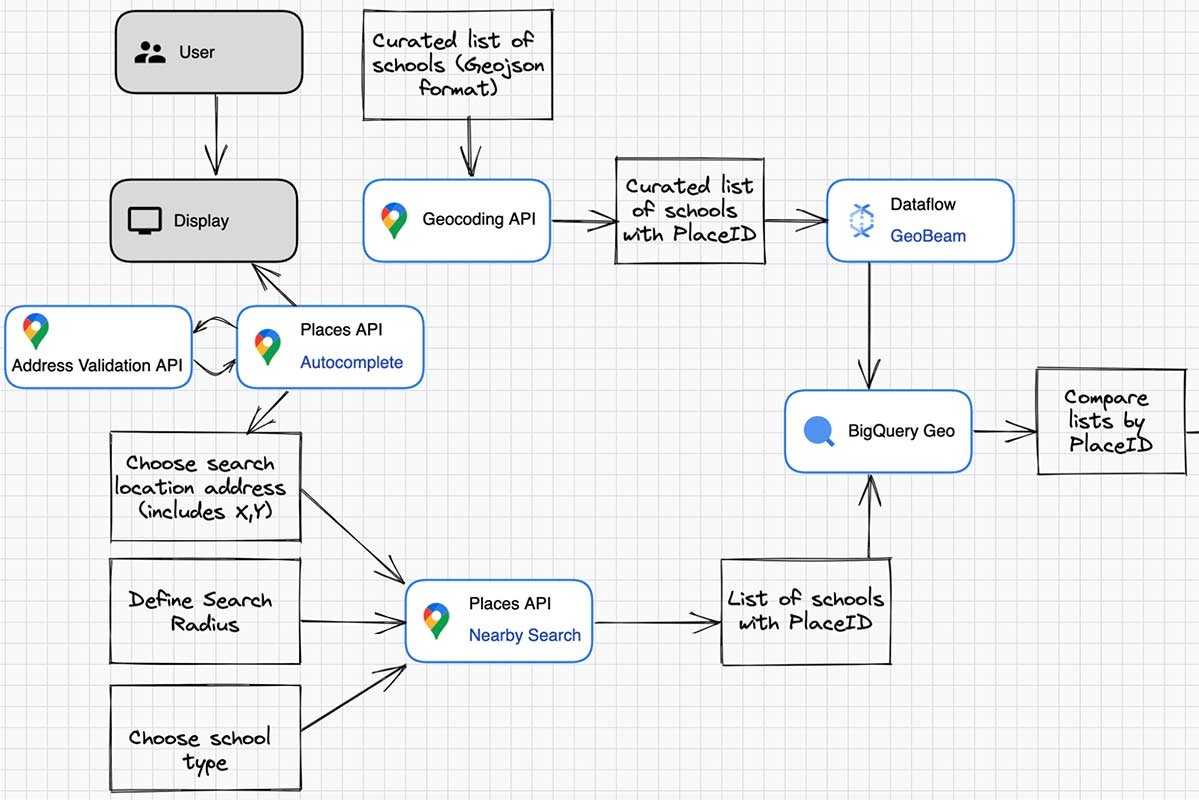
Developers can integrate the Distance Matrix Service with other Google Maps APIs, such as Geocoding or Places, to enhance functionality and provide comprehensive location-based solutions. This integration adds value by combining different data sets for richer user experiences.
User-Friendly Applications
Mobile App Development
Mobile app developers incorporate the Distance Matrix Service to create user-friendly applications for navigation, fitness tracking, and travel planning. This improves app usability and attracts a wider audience of users seeking reliable travel information.
Data Visualization
Interactive Maps
Display travel distances and estimated times on interactive maps using the Distance Matrix Service. Visualizing data enhances user engagement and provides clear insights into travel routes and geographical distances.
Enhanced User Experience
Customer Satisfaction
By leveraging accurate travel information from the Distance Matrix Service, businesses and developers can enhance customer satisfaction. Users benefit from reliable journey estimates, reducing uncertainty and improving overall user experience.
Security and Privacy
Data Protection Measures
Ensure data security and privacy by adhering to Google’s API usage policies and implementing encryption protocols for data transmitted through the Distance Matrix Service. Protecting user information builds trust and credibility.
Continuous Improvement
API Updates and Enhancements
Stay updated with Google’s API updates and enhancements to leverage new features and improvements in the Distance Matrix Service. Regular updates ensure compatibility, reliability, and performance optimization.
Conclusion
In conclusion, the Google Maps Distance Matrix Service offers a myriad of applications across various industries, from logistics and transportation to urban planning and emergency services. By utilizing this powerful tool, businesses and developers can optimize routes, improve efficiency, and deliver enhanced location-based services that cater to user needs effectively.