Navigating public transportation in a new city or even your hometown can be challenging. Google Maps makes this task easier by providing comprehensive and real-time public transit information. Here’s how to use Google Maps to effectively navigate public transportation routes and make your journeys smoother.
1. Open Google Maps
Start by opening Google Maps on your computer or mobile device. You can access it via the web at maps.google.com or use the Google Maps app available for iOS and Android devices.
2. Search for Your Destination
In the search bar, type the address or name of your destination. This could be a landmark, business, or any location you want to reach using public transportation.
3. Select the “Directions” Option
Click on the “Directions” button, which will prompt you to enter your starting point. You can enter your current location or any other address where you plan to start your journey.
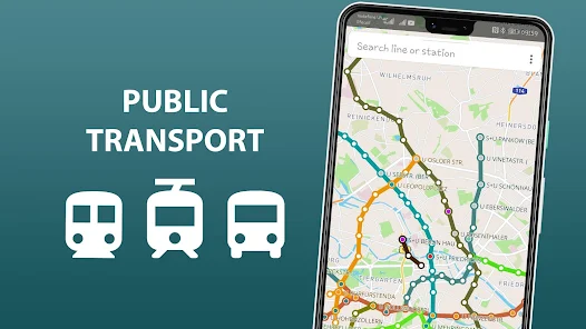
4. Choose the Public Transportation Icon
After entering your starting point and destination, select the public transportation icon (a train or bus symbol) from the available travel modes. This will switch the directions to show public transit options.
5. Review Route Options
Google Maps will display several public transportation route options. Review these options to see different routes, including buses, trains, subways, or a combination of these. You’ll see the estimated travel time, number of transfers, and total distance for each route.
6. Check Real-Time Schedules
For real-time updates on public transit schedules, click on the route options to view detailed information. Google Maps provides departure times, arrival times, and any delays or changes to the schedule. This helps you plan your journey more accurately.
7. Follow Step-by-Step Directions
Once you’ve chosen your preferred route, Google Maps will provide step-by-step directions. Follow these instructions to navigate your journey:
- Transfer Information: Google Maps will indicate where you need to transfer between different lines or modes of transportation.
- Walking Directions: If walking is required to get to a bus stop or train station, Google Maps will provide detailed walking directions.
- Arrival Times: You’ll receive estimated arrival times for each segment of your journey.
8. Use the “Depart At” Feature
If you want to plan your trip in advance, use the “Depart At” feature. Enter your desired departure time to see when you should leave to reach your destination on time. This feature helps you optimize your schedule and avoid long wait times.
9. Save Your Route
For easy access later, you can save your route on Google Maps. On the desktop version, click “Save” to add the directions to your list of saved places. On mobile, you can also save your directions to quickly access them from the “Saved” tab.
10. Get Notifications and Updates
Enable notifications on the Google Maps app to receive real-time updates about your public transportation journey. Google Maps can alert you to any changes in schedules, delays, or disruptions.
11. Explore Nearby Stops
If you’re unsure about nearby transit stops or stations, use the “Nearby” feature to find public transportation options close to your current location. This is helpful if you need to catch a different bus or train en route.
12. Review User Feedback
Check user reviews and feedback for specific bus or train lines to gauge their reliability and service quality. Google Maps often includes user comments and ratings that can provide additional insights.
13. Use Offline Maps
If you’re traveling in an area with poor internet connectivity, download the map area for offline use. Google Maps allows you to access saved maps and directions without an active internet connection.
14. Plan for Accessibility
If you require accessible public transportation options, check for routes that accommodate wheelchairs or other mobility aids. Google Maps provides information on accessibility features for various transit services.
15. Utilize Street View for Station Layouts
Before your trip, use Google Maps’ Street View to familiarize yourself with the layout of transit stations or stops. This can help you navigate large stations or find specific entrances and exits.
16. Combine with Other Travel Apps
For comprehensive travel planning, consider using Google Maps in conjunction with other travel apps or transit services that may offer additional features or real-time updates.
17. Ask for Directions
If you’re unsure about any aspect of your route, use Google Maps’ “Ask the community” feature to get advice and answers from other users who may have similar experiences.
18. Check Local Transit Authority Websites
For the most accurate and detailed public transportation information, visit the local transit authority’s website. Google Maps provides a good overview, but the official site may offer additional resources.
19. Enjoy Your Journey
With Google Maps’ public transportation features, navigating transit routes becomes a straightforward and stress-free process. Enjoy your journey with confidence, knowing you have reliable information at your fingertips.
Conclusion
Google Maps simplifies the process of navigating public transportation, making it easier to get around cities and towns. By following these steps, you can efficiently plan your trips, stay informed about schedules, and make the most of your public transit experience. For more information on using Google Maps, visit the Google Maps Help Center.
With these tips, you’ll be well-prepared for your next public transportation journey, ensuring a smoother and more enjoyable travel experience.